When I was in high school I thought history was the most boring subject ever. Now I know it was just that history had the most boring teachers… and textbooks. Seriously, I don’t know how hard they have to work to make something so interesting seem so boring. However, since I know the secret these days, I love using my travels as an excuse to learn about the history of each place I visit. Bohol is far richer in history than I can fully explore here, but I enjoyed learning more about it, and I hope you will too.
Mostly Catholic Churches
I visited many of the large cathedrals left over from Spanish occupation that had distinctive stone architecture and European influenced art, but driving around I saw a great many smaller centers of worship. Most of the small churches around the island are a single “room”, wall-less or lattice walled affairs where the neighborhood can gather to worship. I took that picture on the right from the street. It’s not under construction, it just doesn’t have a wall there.


They are very devout Catholics over there. One evening on the way to dinner from the hotel, I drove past a procession of some kind, a mixture of genders and ages, but 4 men were carrying a liter with a statue of (probably) the Virgin Mary and a mountain of colorful flowers. They walked down our small street singing Ave Maria as they trailed after the statue. I didn’t take any pictures in part because I was driving, but also I felt it would have been a bit rude. These people weren’t worshiping in a place that was heavy with tourists and I felt as though I’d been allowed to witness something very personal.
The large historical cathedrals are well marked tourist spots however, so I have plenty of photos of those.
Panglao Watchtower & St. Augustine Parish
Before visiting, I didn’t know much about the history of the island other than a little bit about the Spanish colonization. However, the watchtowers are listed on a great many “to do” collections, so when I noticed one nearby on Google Maps, I decided to stop and check it out. As I pulled in, several young men asked if I was there for an island hopping tour. This was one major tourist attraction I decided against before arriving simply because the descriptions I read online made it sound like a horrible hassle for little reward. I politely declined and found a shady tree to park under near the church of San Augustine. Some nearby cows who wandered over to see if I had anything interesting, but soon realized there were no treats.
The Panglao Watchtower is located on the south end of the island. It is 5 stories high, making it the tallest structure on the island. It was built in 1851 by the Spanish, and is in serious disrepair. I know almost nothing else about it, because it’s not a popular enough historical site to have much published about it online. I did find that around that time the Spanish and Filipinos were having a bit of a tiff over things like government control and secularization, so I suppose the watchtower built next to the church may have been out of a concern that the church could be attacked by secularists?

I wandered around taking photos of the tower and the mangroves nearby before moving to the church. There were people inside, it was a Sunday after all, but it seemed to be a small meeting and not a full congregation and they were confined to one section of the church, so I quietly stepped in to an empty area to look around and take a few more pictures inside. As I stood looking at the art and architecture, I was struck by the very Spanish style before remembering that colonization of the Philippines was Spanish and not British.

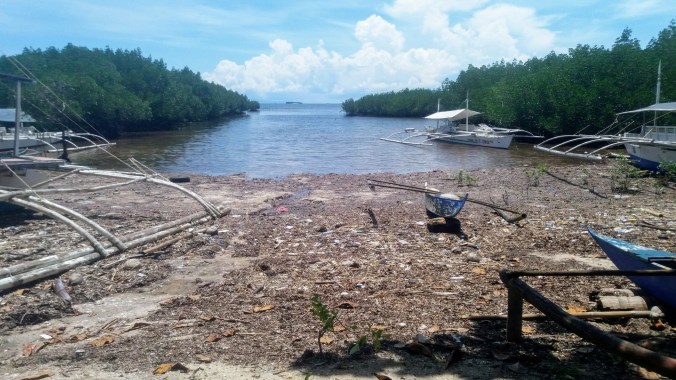
Finally, I walked out along the end of the pier all those island hoppers were using to see the ocean view. I didn’t know it at the time, I only found out days later when a restaurant owner told me, but apparently a local church runs a free ferry to the nearby Virgin Island (a stop on the island hopping tour), and if you want to know more, you’ll have to go to Nikita’s Coffee Shop and ask the old British guy who runs the joint, as I never had the chance to find that particular boat.
Dauis Watchtower, Our Lady of the Assumption Parish, & The Miracle Well
My next goal was to find the Miracle Well, which is located at the Our Lady of the Assumption church on the north end of the island. There is a little matching cathedral and watchtower at both north and south, although the northern watchtower was so much shorter that I almost didn’t see it at all.


The church is just next to the bridge that leads over to Bohol. It’s easy to find parking, and the grounds are lovely. I wandered slowly around taking photos of the exterior of the church, some of the statues and grottoes around, the sea nearby, and a little brood of baby chicks because they were insanely cute. The watchtower is so low that I have no idea what one would be watching from it’s second story window, but it seemed to be a part of the set. Unfortunately, by the time I finished exploring the exterior, they were just closing up for lunch and I didn’t get inside (don’t worry, I came back another day).


Our Lady of Assumption is so close to the bridge to Bohol that I was able to pause there again on my way elsewhere for another shot at getting inside the church and finding the Miracle Well, but it wasn’t until my third stop at the church that I finally succeeded. At long last, the church was both open and unoccupied, so I was able to get inside without interrupting services.
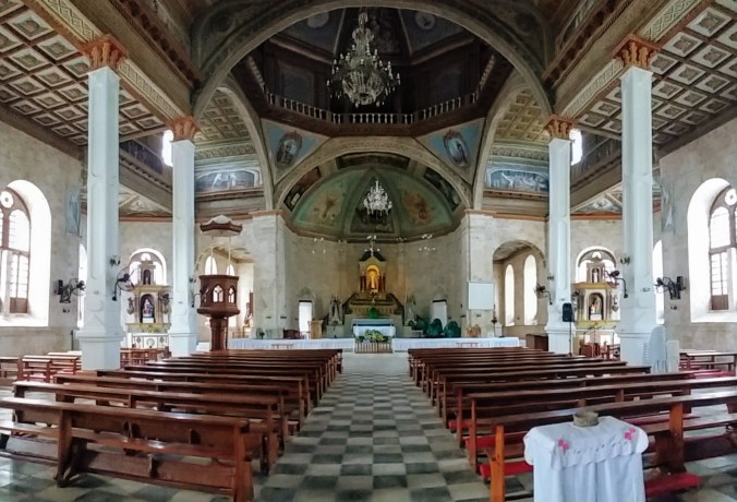
It is an open and intricately decorated church. Either it had been untouched by the earthquake or had been lucky enough to earn a full restoration because the inside was in excellent repair. The large sanctuary had stone walls, but also large windows to let in light and air. It was an interesting combination of the European style and island style. I wandered around taking pictures and looking for the well, which is supposed to be near the altar.
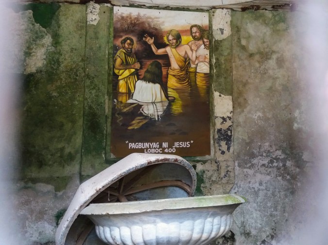
According to myth, the town was under attack by pirates (a thing which did happen regularly), and all the townsfolk locked themselves in the church (big stone building, makes sense). However, the pirates were determined and began a siege, trapping the townsfolk inside with no water! Then, miraculously, a fresh water well sprang forth at the foot of the altar and saved the people inside, allowing them to wait out the pirates who I suppose either got bored or were driven off by the Spanish navy. The well remains a source of fresh water to this day, despite the fact that it is a stone’s throw from the sea. The church offers bottles of this miraculous water for a donation of your choice.

I searched everywhere. I saw no well. I looked online for images that might give me a clue where the well was, but the interior seemed to have undergone a remodel, and the few photos of the well I found were such close ups that I could not tell where in the church they were. Was I even in the right church? There were no signs, no informative plaques to tell visitors about this amazing miracle. Had I really come to the wrong church three times looking for a well that either didn’t exist or had been destroyed in the earthquake?
Finally, on my way out, I saw a small office with some people who looked at least a little bit like they were affiliated with the church and asked. A very kind lady not only assured me that this was the correct church, but led me over to the well, which was hiding unobtrusively amid a low wooden railing that separated the parishioner’s pews from the priest’s area.


I had seen the railing and the signs on it that said “no entry”, and had looked no further, but in one little section, the railing goes from being a single line, to being a square and there is enclosed the well, covered with Plexiglas to keep anything or anyone from falling in.  She took up a nearby lamp and shone it into the depths so that I could see the water below.
Once I’d taken a few photos, she walked me back over to the office and fetched a bottle of the “miracle water” for me to try. Of course I left a donation, don’t be silly. And since tourists are advised against drinking the tap water here, you’ll be happy to hear that I suffered no ill health from the miracle well water. Maybe that’s the miracle?
More photos of the St. Augustine & Lady of Assumption Churches.
St. Peter the Apostle Parish Ruins
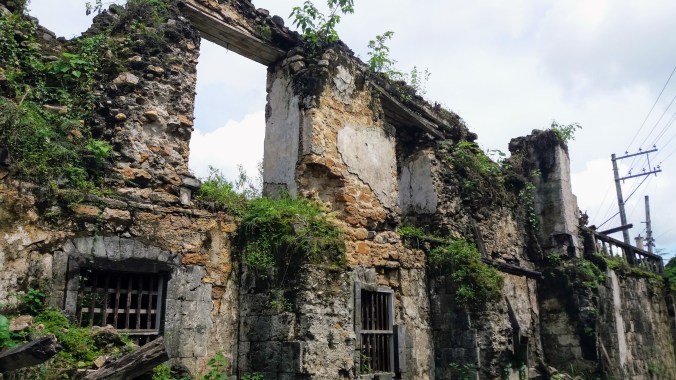
After the river cruise, I headed across the street to see the Loboc Church, aka Saint Peter the Apostle Parish Church. The full history of the Spanish colonization here is for a later time. For now, suffice it to note that this church was the second built on Bohol by the Jesuits. The Parish was done in 1602, but the coral-stone building that (mostly) stands today was finished in 1734. Then in 1768 the Jesuits were tossed out and another Catholic group called the Order of the Augustinian Recollects took over. I’m not going to try to explain Catholic orders here, feel free to wiki that if you have a burning desire to know. It’s also been declared a National Treasure by the Philippine government, and is under consideration for UNESCO heritage sites. It was absofrickinloutly beautiful (judging from photos) before the 2013 earthquake and now it is a stunning ruin.

I had spotted the ruins when driving to and from the Chocolate Hills earlier in the week, but at the time I was hurrying to get there or exhausted and ready for bed, so I was pleased to have carved out some time just to go and ogle the ruins. I know it’s tragic that the earthquake destroyed so much, and I’m sure I would have enjoyed seeing the church in it’s glory, because photos really do look lovely, but there is something about ruins being reclaimed by nature that just draws me right in. Even though it’s only been 4 years since the earthquake, the locals have just not been able to raise enough money to complete repairs and other than some scaffolding and a few gates to keep people out, the structure has been left to the onrush of jungle foliage.

Trees have sprouted in the walls. Ferns and mosses creep across the stone carvings. I peeked in barred windows to see the remains of a baptismal font, and peered through gated doorways to see the interior filled only with more layers of scaffolding. It’s clear that they do not wish to simply leave the church to decay, but very little has been done in the 4 years following the destruction. To me it was the perfect combination of man-made beauty and natural power.
At one point, I moved up close to get a good photo of some carving and I noticed the odd texture of some of the stones in the wall. They seemed to be organic. I know there are some crystalline structures that can appear organic, but these struck me as being especially sea-like and I wondered at the time if the stones may have come from a once-upon-a-time sea floor limestone quarry. I saw more of the same stones in other ruins once I knew what I was looking for, and vowed to find out when I got back. It turns out the answer is fairly simple, and I wasn’t far wrong. It’s not so much an ancient sea bed quarry, as a coral quarry. I had no idea coral could be quarried for building materials, but this happens in several islands in the Caribbean and South Pacific. Sometimes the coral is sliced into roof tiles, sometimes it’s mixed in with other ingredients to make a kind of concrete, and sometimes it’s big enough to hew whole building stones from, leaving some of the churches of Bohol with fascinating fossil structures in their walls.


I spent close to an hour circling around the crumbling church. The detail in the stones, the tiny plants and the hidden carvings and grottoes were entrancing, but eventually the heat and sunshine drove me back to my bike and back on the road where a welcome travel breeze cooled me off once more.
Baclayon Church
I will admit that my itineraries were largely informed by picking a single destination based on interest or reviews, and then examining the map to see what else was labeled on the roads I would be driving. I mean, if you’re in control of your own transportation, there’s no reason not to pull off to at least have a look when passing by landmarks, right? I don’t think I would have gone on a church tour in the Philippines for it’s own sake (although I did go to several in Europe because architecture!), but I’m glad I had the chance to see the buildings.

I had a suspicion by this time that I’d actually seen the Baclayon Church before, but not stopped at it. Looking at the map that day, I was sure it was the church that was visible from the market I’d stopped at for snacks on that first drive up to Bohol while going to the Chocolate Hills. And lo, I was correct. It was a little tricky to find the entrance, but fortunately Bohol is not a heavy traffic place, so if you get lost its easy enough to pull over or turn around.
The Baclayon Church (also The Immaculate Conception of the Virgin Mary Parish Church) is the oldest Christian settlement in Bohol, established by the same Jesuit group that had set up the Loboc Church. It was first colonized in 1596, and the finished coral stone building that stands now was completed in 1727. It was also taken over by the Augustinians. It was also declared a national treasure. And it was also a short-lister for UNESCO world heritage sites before the earthquake hit. However, unlike the Loboc church which is nearly untouched, the Baclayon Church is well under way with repairs. I ran into a construction crew on the far side actively working.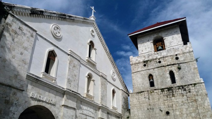 There is very little sign of damage on the exterior. This is not because the damage was minimal, but because the effort has been great. There was a before and after photo out front as well, showing what the damage looked like just after the quake and it’s much closer to what Loboc Church still looks like. I wandered around the exterior taking more photos and found several more blocks with that organic sea-life look that I now know to be coral stone. It seemed that the sanctuary proper was still under construction, but it is scheduled to re-open this year.


The museum, reliquary and gift shop are all open to the public. I have never seen so many rosary based trinkets in one place as that gift shop, I think some may have been several meters in length while others appeared to be made of glow in the dark materials. The reliquary is at this point in time simply a loose collection of the relics and art that adorned the church and (mostly) survived the damage: statues, a few rather terrifying mannequins and a version of the Pieta with some loose wigs. Still, it’s clear that these were all valuable historical displays and they were gathered together with care. I’m afraid I declined to enter the museum proper that day.


More photos of the Loboc and Baclayon Churches.
The Blood Compact Memorial
One of my favorite travel techniques is to look at a map or a tour to-do list, see a thing with an interesting name, visit it, realize I have no idea what it is about, take a ton of pictures, and look it up when I get home. The Blood Compact is a perfect example of this formula.
When I programmed my map app to take me there, the destination was a place I had driven past at least 3 times during the last week, yet unlike the Baclayon Church which I was confident of having seen while driving past, I could not recall anything at all where the map was pointing me. Confused, I pulled up the street view, hoping to get a better idea of what that stretch of road looked like, and Google insisted on pointing me to a patch of grass on the side of the road with nothing around it. This is not the first time that happened on this trip since some things are set back off the road, either down a slope or behind trees where the cameras missed it. Since I had to drive that way to get back to the hotel anyway, I decided to give it a whirl.

I only realized I’d driven past when my app dinged in my earbuds. When I pulled over to look around, I spotted a tiny little monument set back from the road back the way I’d come. I turned around to get a better vantage point and took my “I was here photos”, but there didn’t seem to be anything other than this small wall, explanatory plaque, and a trio of wayward goats.


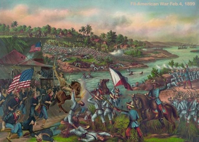
“About the middle of March, 1565, Captain General Miguel Lopez de Legaspi’s fleet anchored along this shore. Shortly thereafter, Legaspi, manifesting trust and confidence in the islanders, entered into a blood compact with Datu Sikatuna, for the purpose of insuring friendly relations between the Spaniards and the natives. A few drops of blood drawn from a small incision in the arm of each of the two chiefs were placed in separate cups containing wine, and in the presence of the followers of both, each chief drank the potion containing the blood of the other. Thus, during this period of colonization, a bond was sealed in accordance with native practice, the first treaty of friendship and alliance between Spaniards and Filipinos. –1941”
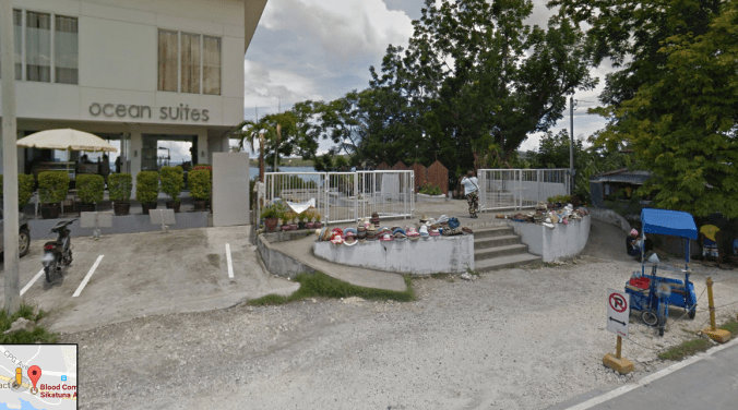
Later, while doing my “now what did I just see” research, I found all these cool pictures of a bronze statue of the ceremony! Where even was that? There are two places on that road labeled “Blood Compact” on Google, and I’m willing to bet that a lot of the people posting photos of the statue were part of a tour group with a guide who knew where to go. Looking at Google Street View in retrospect, I found both the plaque and the bronze statue in different places. The plaque is next to a convenience store and somewhat down a slope from the roadside. The statue is next to “Ocean Suites”, on a raised dais, behind a white metal fence. I may have driven past it and thought it was part of the hotel. *sigh.
How About That History?
I am not going to write a comprehensive history of the Philippines, or even come close. This is a highlights reel to put the current socio-political and economical issues the Philippines is facing into context for those of you who, like me, found your history books mysteriously silent on the fate of small island nations.
Colonialism
A whole bunch of countries were scrambling to get to the East and get the precious SPICES! The Portuguese, Dutch, Spanish, British, Ottoman, and even the Chinese and Japanese were all out to expaaaaaaand. That’s how I got a country, and how lots and lots of indigenous people lost theirs. The Portuguese and the Ottomans were being a bit rude in the Philippine Islands, so when the Spaniards showed up on Bohol and were like, “oh no we are not like those silly Portuguese!” The natives were happy to make this treaty with them, and the Boholano people are still quite proud that their ancestors made the first friendship treaty with their eventual oppressors… Yeah, I don’t like colonialism.

Image – Front National SA
Which makes this next part extra sad.
A few hundred years of all those empires competing over SE Asia and South Pacific islands of military strategic value meant that even though the Spanish held the Philippines officially until 1898, there were plenty of battles, skirmishes and invasions where someone else took control of Manila or other islands. Basically all the rich kids fighting over the land and the native people getting boned. Sometimes the natives did rebel, I think the longest single rebellion lasted almost a hundred years in one part of the country, but none succeeded at driving their European overlords out. The part that came as a complete and total shock to me is that Spanish rule of the Philippines did NOT end with independence in 1898, but rather with the sale of the island nation to …(dun, dun, dun) THE USA! …at the end of the Spanish American war.
The Philippine American War
Mere days after the transfer of ownership, the Filipinos tried to declare their independence once more. While we (Americans) were busy fighting the Spanish American War, the native Filipinos were simultaneously fighting Spain for their independence. Was the democracy loving US *helping* little Philippines? No, because we were still pretty darn isolationist in 1898 and hadn’t gotten into the habit of having the giant standing army we like to send around on “peacekeeping missions”. We were actually fighting Spain for control of their islands like Cuba. By the end of the war, they signed over Cuba, Guam, Puerto Rico, and the Philippine Islands, although apparently the US paid 20$ million for the last one to cover infrastructure costs.
By the way, we still own Guam and Puerto Rico, but won’t let them be states (have representation) or apparently get decent federal aid after a devastating hurricane.
Having been engaged with the Spanish for their freedom, the Filipinos were not actually on board with the sale, and declared themselves independent and published a lovely constitution. The US, on the other hand felt it had paid some hard earned money for the territory and so began the Philippine American War, which I had actually never heard of until now. The Filipinos lost, and America continued to OWN the country until after WWII when we were generally making everyone (mostly Britain) give back all their colonies and decided to use the Philippines as our “set a good example” colony.
Military Dictatorship
Shortly after WWII, we get to Ferdinand Marcos who started his career in the House in 1949 (just a few years after officially free Philippines happened) and eventually became the President who implemented strict martial law from 1972-1981. It was a military dictatorship, and a seriously brutal time, and why am I telling you about it here? Because although the was finally ousted by a revolution in 1986, his rule was a major threat to democracy there and rife with cronyism, favoritism, extortion, and flat out ignoring the constitution. And the guy in power now is making a lot of people draw comparisons.

image tenminutes.ph
Like many countries, the Philippines was not proud of that time in it’s history and as a new generation grew up in the light of the revolution and the restoration of democracy, they weren’t always well educated on the dark side of Marcos’ reign. Too soon, people began to think that stricter measures and even martial law could be good tools to help the country.
Democracy and Death Squads
Enter Duterte. Another lifelong politician, he has risen to popularity and power with the aid of DEATH SQUADS. I’m not kidding. In order to “clean up” the country, he has repeatedly and publicly declared that it’s ok to kill criminals without trial. This includes drug dealers, drug users, petty criminals, and “street children”. If you aren’t gagging in horror, you may need to get checked for your humanity.

image Reuters
He’s also said unbelievably horrible things about wanting to rape women, wanting to kill people who cause problems with extreme violence, and pardoning everyone under his command who committed human rights abuses while carrying out his orders… if this sounds like any other world leader you may have seen on tv in the last year, you are not alone in thinking this.
Responsible Tourism
This left me in a tricky position vis a vis being a tourist. I did not feel in danger in Duterte’s bloody cleanup because they are in no way targeting foreign nationals in this death squad round up. But economically, it was a tough choice. I know that my tiny vacation budget is not going to have an impact on the national economy of the Philippines, but it just might have an impact on the lives of the small business owners, guides, and environmental preservation programs that I do want to support and that I desperately hope survive until the next era of democratic sanity is restored. So, yes, I went and I feel ok about that.


 Next I headed back towards the center of the island to the arts and crafts village where handmade goods can be viewed, created, and purchased. My favorite was a metal tree dripping glass globes that caught the winter afternoon sunlight. There were also plenty of places to grab a hot drink, a snack or a meal.
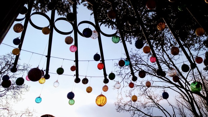


 I went to the Alona Market on the first day.


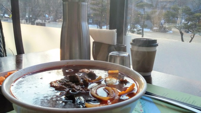
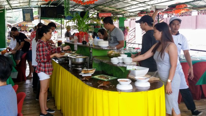 It was not the best meal I had on the trip, but everything was good and it’s a buffet so you can eat as much as you like, as long as you don’t leave food on your plate (they charge 50p for leftovers to discourage food waste).

 After 2 and a half hours of driving, we finally made it to the Chocolate Hills Lookout (sometimes called the Chocolate Hills Complex). There was a line of cars and vans stopping at something on the way, but they all looked like tourist groups and there were no clear signs, so we just drove around them and on up to the parking lot at the top. Motorbikes always have a separate parking area from cars here, so we pulled in and were asked for our tickets… which we didn’t have. I’m not sure if that was what we should have done in that long line of cars or not, but it didn’t seem to bother anyone, we just gave an attendant the money for the parking and tickets and she returned with our passes and receipt. We left the bikes there, and although we had to leave them unlocked, the lot was watched so we weren’t too worried.
 When going to view the Chocolate Hills, there are two main scenic points, the one I went to, and another on the opposite side called Sagbayan Peak. The descriptions I’d read online make Sagbayan seem like a great place to go with kids, with a water park and giant animal sculptures and other places to play, but after a 2.5 hour drive to the Complex in Carmen, I opted not to drive to Sagbayan as well. There are other places to get a view, and there are some ATV rental places you can do an off road drive in the area, but it seems like the best way to be sure of getting a nice look is to go to one of these two peaks for a high ground advantage.
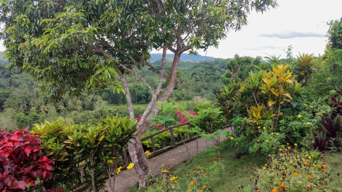 Once we completed the survey of the base level, we headed over to the stairs. I’m not a champion stair climber, but there were lots of places to stop, and a few side paths for extra sights. It’s not too much of a climb for all that it’s the tallest of the hills. Part way up is the turn off to see the “Our Lady of Lourdes” Grotto. The Philippines are mostly Catholic, a holdover from the Spanish colonization. There are churches and shrines everywhere, but I don’t mind too much as Catholic art tends to be beautiful, and no one was trying to convert me.
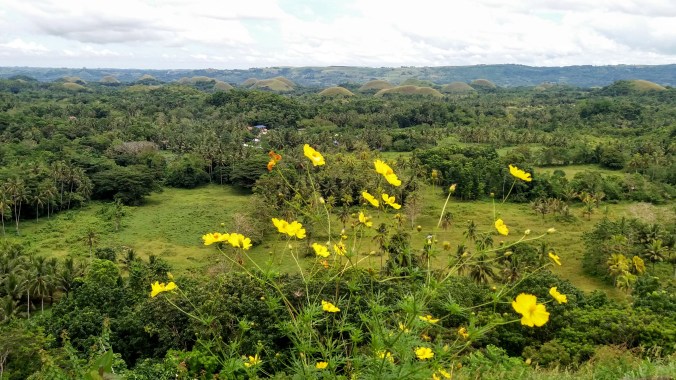 I took about a million pictures of beautiful flowers and the shifting view on our way to the top. And when I finally reached the peak, took obligatory selfies from the viewing platform. I also went to find the not-actually-famous-at-all well with a a bell to ring the bell and make a wish. There was also a cute little backdrop on one side for people who like to pose with man-made scenery. I liked it despite or perhaps because of it’s total kitsch, but I’m glad it was off to one side and not covering the whole viewing platform.
 Even as the week continued, we experienced very little rain. I am told that the rainy season is short but has strong showers every day, and the hotel hostess did say that the weather was a little unusually dry for my visit, so maybe I just got lucky? Anyway, not wanting to be caught on the very top of the highest peak around if a thunderstorm hit, we began to descend the stairs.
 One of the many things I found online about Bohol was the prevalence of adventure parks. We have these in Korea too, and for some reason I still haven’t ziplined. The Chocolate Hills Adventure Park advertised a kind of zip bike, where you pedal a special bike (with a safety harness) along a zip line between two chocolate peaks. I have nothing against ziplining, it just doesn’t seem like a great way to actually see anything, so I keep putting it off in favor of taking in sights until I manage to find one in a place I’ve thoroughly explored. But this bike thing seemed unique and slow enough to get a great view with plenty of time to look around and admire the scenery instead of zipping through it.
 I read online that the park had a weight limit, but we decided try anyway and see how much they actually meant it and how much was just a liability disclaimer. It turned out to be sort of both. We were each a few kilos over the weight limit, but instead of telling us straight up “no”, the staff advised us to head on up to the zip bike area and try on the harness with the safety guide to see if it would fit anyway. In retrospect, I’m not sure if this was their way of shifting the responsibility or not. I think if we’d been WAY over the limit they would have turned us away, but since we were close?
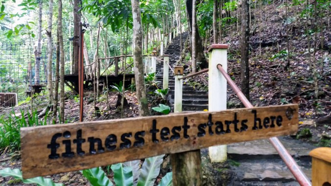 We headed further in, following signs to the zip bike and were led to a steep stone stairway with the sign “fitness test starts here” at the bottom. I theorized that anyone who couldn’t climb the stairs to the starting point wasn’t fit enough for the activity, and we began the ascent. Whatever your opinions of stairs are, know that the jungle makes it harder. Humidity. Nonetheless, we persevered and made it to the top and were rewarded with a breathtaking view and a less than stellar ride attendant. I do try to give people the benefit of the doube, and maybe she was annoyed with her coworker on the radio or something else we couldn’t even see and not with us at all, but it was clear she was annoyed with something.
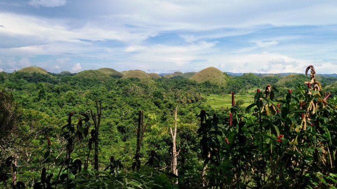 We waited on the viewing platform, and I have to say that even though we’d just come from the tallest peak in the hills, the Adventure Park’s view was stunning. I don’t think I would have gone there only for the view, but it was certainly a nice perk. We also watched a few more tourists take the bikes out and back on the lines from the tower above us to the hill next door. The attendant at first told us that we had to wait due to lightning (the storm that had just passed us?), but then we saw people riding anyway? I’m not sure what was the deal there. I also accidentally got doused in ants trying to take a picture of the hanging trellis flowers. The ants really liked the flowers too, and when I bumped into one, they transferred from the petals to me. Thankfully, they were just small black ones, and I was able to brush them off with no bites, but it reminded me to keep an eye out for what I touch or lean on in the jungle.


 If you’re going to the Adventure Park anyway, go ahead and visit their butterflies, but don’t go out of your way for this display. We were accompanied by a guide who had been trained to take lots of pictures for us (with our phones, they weren’t trying to sell them back to us or anything, but Asian tourists especially love appearing in their own travel photos in a way I never will) and move people through. She showed us a display on the life-cycle of a butterfly, and we got to hold a caterpillar. Then we walked through a path in a netted off part of the forest. We only saw a couple butterflies and at one point our guide threw a rock in an attempt to get on up on the top net to fly. We quickly stopped her from continuing that and said we were fine with the way things were. She said the butterflies were inactive because of the rain, but I felt like I’d seen half a dozen just climbing down the stairs from the zip bike.
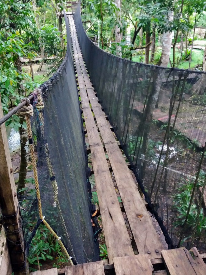 After the butterfly enclosure, we were guided over to the suspension bridge which is included in the park entrance fee already. This kind of bridge through the canopy is another very common tourist must do in Bohol, available at multiple locations. Even though I may not deliberately go looking for the silliest touristy things to do, I’m hardly going to turn it down if it’s right there in front of me. We had fun, and got a nice view of the park from the air before descending the stairs on the far side and heading back to the bikes.
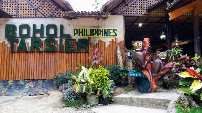 Following a delightful and refreshing stop for some locally sourced buffalo milk ice cream, we headed back down the main road where were would be able to find the Tarsier Conservation Area (not to be confused with the “Philippine Tarsier Sanctuary”). Bohol is also famous as the home of the world’s smallest primate, the tarsier. There are two tarsier spots near the Chocolate Hills, and it was worth it to me to visit both, since I was already planning other road trips near each one. I’ll say now, if you can only do one, do the Sanctuary, but seeing both was nice.
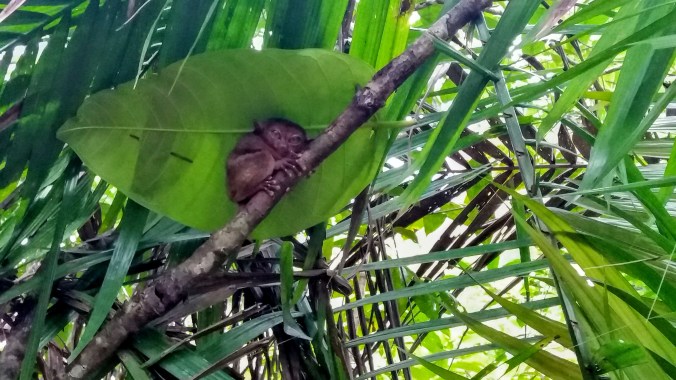 I can’t be sure if they are placed at these viewing stations or if the park simply made attractive bowers in good places and hoped. I did see one little guy hanging out in a not great viewing spot with no guide to point him out, so at least a few must be slightly rogue. We were also told they are territorial, and tend to stay in or near one tree as adults.
 Whether we like it or not, tourism is the main reason species like these will survive. In fact, the growing interest in ecotourism is a big part of what’s paying for conservation in developing countries. It can be hard to draw the line between exploitation and preservation, but I think the Conservatory is leaning on the right side. Of course, the park dumps you back into a souvenir shop between the exit and the parking lot which was full of tarsier themed everything, and one shelf of wooden phallus ashtrays for no discernible reason at all.
 Several days later on my way to a lunch cruise on the Loboc river, I started out extra early to make time for the Philippine Tarsier Sanctuary to see how it compared to the Conservation Area. I tried to get there as close to opening as possible to beat the crowds of tourists, and I think I very well may have been the first customer of the day since cashiers had to be found, then change had to be found. It’s not an expensive tour, but like every little adventure in Bohol, it does cost a small amount to go in. I got a personal guide who walked me through a kind of netting air lock into the forest beyond.
 While the Conservation center had been paved paths with guides stationed at each Tarsier, the Sanctuary was much more a natural jungle with mud paths through the trees. I doubt I would have gotten lost in the small area behind the building, but I certainly wouldn’t have seen as many tarsiers without my guide. The Sanctuary is closed in, but the fence and netting are very unobtrusive, designed more to keep predators out than to restrict the tarsiers. I also felt like the tarsier perches here were probably man made to encourage the critters to good viewing sites, and to make sure they were visible from the paths while being sheltered from the sun. However, where the Conservatory perches were obviously man-made, the Sanctuary perches looked far more natural, drawing less attention to themselves and who knows, maybe being more comfortable.
 My guide quietly and confidently led me through the tangle of muddy paths, stopping every few minutes to point out a tiny sleeping primate. I was surprised at how close they were to the path after my experience at the Conservation center. While I’d been hard pressed to get any decent photos at the Conservation center, I had merely to hold up my phone to be close enough for great detail here at the sanctuary. I was worried about disturbing the little critters, so I tried to keep a reasonable distance, although more than once they were close enough for me to have reached out and touched, I know that would have been dangerous and damaging for them, so I resisted the urge. My guide was in no rush, and was happy to stand by while I got a good look at each one, and until I was satisfied with my photos. I can’t say I always had a good photo before I decided to move on, since I was keenly aware that simply by watching me back, I was keeping them awake and didn’t want to become a source of greater stress. I probably stayed at each spot between 2-5 minutes before moving on.
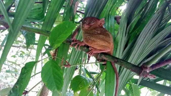 The Sanctuary jungle was also the hottest thing I did on this vacation. The trees were so close together and the netting caught the breezes, so even at 9:30 am it was sweltering hot and I was drenched in sweat the whole time. It was entirely worth it.
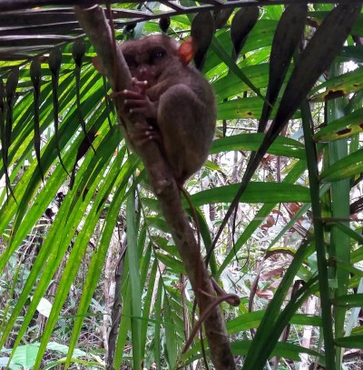 It was so peacefully quiet and there were no other visitors in the park so I felt very special getting to have this beautiful jungle and adorable creatures all to myself. I talked to them in soft reassuring tones like I was trying to sooth a scared kitten, and I have no idea if that was effective at all or just my own human oddness, but it was so obvious that they were watching me back, I couldn’t help but wonder how many myths of goblins or fairies these peculiarly shaped animals inspired. Their eyes are so large in comparison with their heads and yet the gaze is penetrating. Their hands are smaller than a newborn, but their fingers long and deft with large pads at the tips like a lizard or a frog.
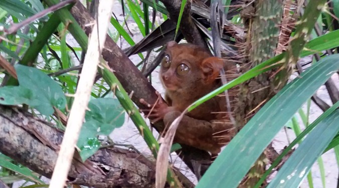


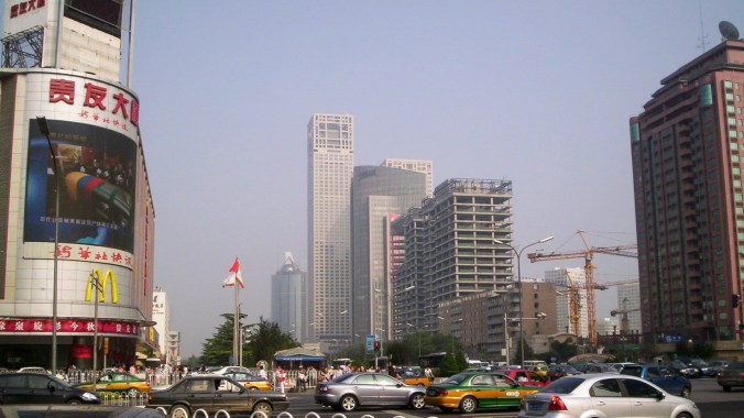


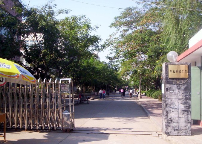
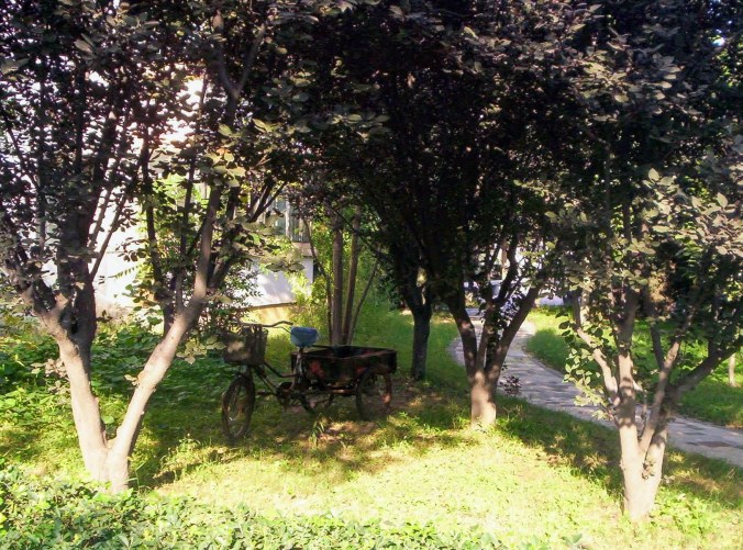
 And last but not least, the army kids. Some of you may be aware that military participation is mandatory in China. So all the freshmen, rather than starting their classes, are participating in military training, which seems to consist mostly of learning how to march in formation. They have been shouting outside the classrooms all week, and I often have to yell to be heard over them in class. I took some pictures of their drilling practices, and tonight I’m going to some kind of show which is being held in the football field (apparently that they’ve been preparing for, hence the yelling), that thing that looks like a bunch of colored squared on the north west corner of campus is actually a football field that they’ve covered with a plastic tarp and chairs. Ladies and Gentlemen, I give you, the People’s Army…


 Since arriving in Thailand via Koh Lipe I had seen these tiny ornate houses on posts everywhere. I saw them on the remote islands around Lipe, near the caves of Bor Tor, in the cities, at gas stations, and in the front yard of homes we passed on the road. Some were simple, others like miniature mansions. Some had tiny model occupants while others were uninhabited. Nearly all of them had offerings of food, sweets, alcohol, or incense.


 The morning after my late night and less than welcoming arrival, I woke up early, scarfed down my leftover convenience store sweet buns and took off to find the train station that would lead me to the Batu Caves. In recent years, the Malaysian government has added a train stop at this popular tourist attraction, and now it’s much easier to get to. The train itself was a new experience. When you purchase a ticket, you are given a plastic token with an RF chip inside. When entering the platform, you hold the token up to a pad to be read and it opens the gate, but hold on to that chip! When you disembark, you need to feed the chip into a slot to pass through the exit gate.
 I met a tour group on the train platform and we chatted during the train ride. I hung around with them and their guide to hear a few of the explanations offered about the caves. The guide rushed us past the dozens of sales stalls (saving us from souvenir swindles), gave a brief presentation under the statue of Hanuman (the Monkey King) and landed us in the main square at the base of the stairs and the giant golden statue of Murugan (a god of war, made of concrete and painted gold colored). There was a tremendous flock of pigeons in the main square and it seemed to be a major tourist attraction to stand in the flock and have them hop onto your hand to get some food. Occasionally construction in the background caused a loud boom that set all the birds a flutter, which was surprisingly pretty.


 After a few obligatory photos with the tour group and the giant statue, we began the climb. The stairwell is not insanely long, a mere 272 steps. They were so popular as a form of exercise that the government had to ban fitness use of the staircase to keep it clear for tourists and worshipers. With my kryptonite-like response to humid heat, the staircase became a long haul obstacle, but there were plenty of interesting things to stop and look at on the way up, like the expanding view of the courtyard and city below, the rock formations on the cliffs along side, and of course the hordes of monkeys roaming freely through the grounds. Given that the monkeys are wild, I was totally happy to keep my distance, but they were not shy and enjoyed coming right up to tourists or even forcing a showdown over who got to use the hand rails. At one point there were two monkeys perched on twin posts on either side of me and I managed to get a cute double monkey selfie, checking off a bonus square in the Batu Caves tourist bingo.
 When I finally got to the top, I was greeted with a large cave mouth opening that led to an even larger cavern. The entrance of the cave had small buildings installed for souvenirs and police. Once all the way inside, I could see that although this huge open space was graced with a few decorative statues around the edges, it was largely left in its natural state. The cave mouth was wide and there was a natural sky light further on, so the cavern was well lit. There were a few artificial lights in strategic places and an area of worship off to the left. Finally, there was another short staircase leading through to the open area beyond. At the top of those stairs was the rearmost chamber of the cavern, another broad space; however, the roof had long since fallen in and the walls soared up into open air, creating a round room with no roof.


 As I exited the temple section to descend the stairs again, I detoured off to the right to investigate a “dark cave”. The Malaysian government has taken this side section of limestone cave and created a conservation space. The limestone quarries and careless unregulated tourism of the recent past had wiped out a lot of the cave ecosystems. Efforts to restore the guano based ecosystem of living limestone caves are now underway in many parts of Malaysia and this cave was for both preservation and education.
 Nearly everything that lives in the cave is so tiny you wouldn’t even notice it if no one stopped to show you. When we see nature documentaries, there’s often nothing for scale, so it’s easy to imagine the animals as being similarly sized to their daylight counterparts. When our guide showed us a picture of the little white snail that lives on the rocks, I imagined a tiny snail, but not nearly as tiny as the ones we found! The biggest of the snails was about the size of a grain of rice, but there were smaller ones dotted around.


 As I descended back to ground level, I passed still more monkeys, several sets of mother and baby wandered around, and some tourists were feeding them peanuts (despite the do not feed signs). I noticed that the dominant males were very protective of their snacking rights and would drive off the mothers aggressively. Of course, no trip to a monkey colony would be complete without a little fornication. I happened to be standing right next to a female when a male walked up, took her butt in both hands and peered at it closely, then proceeded to mount her, much to the shock and amusement of tourists from 6-7 different countries. No, I did not take monkey porn pics.
 Farther on, beneath the looming statue of Hanuman we passed at the beginnging, was the Ramayana Cave. This attraction was much more highly reviewed and was only 5 ringgits to enter, so I decided to give it a shot. There is a stream inside the mountain that comes out and is used as part of a beautiful fountain depicting the chariot of Rama and Sita. If you’re not familiar with the


 but the main floor had a few shops and restaurants. I pulled into the first one I saw and confessed my massive ignorance of Malaysian cuisine, asking the staff for a recommendation. Moments later I had a heaping plate of some kind of fried rice dish that was smokey and pleasantly but not overwhelmingly spicy. Sometimes you just gotta walk on the road that looks more interesting.